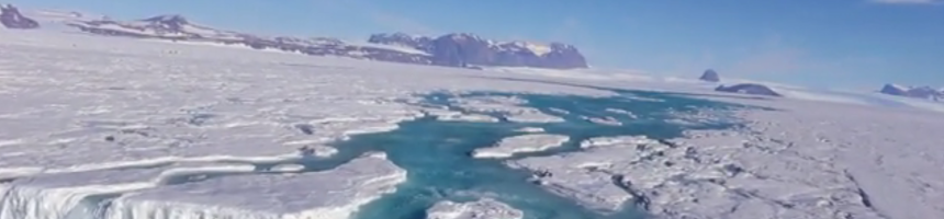
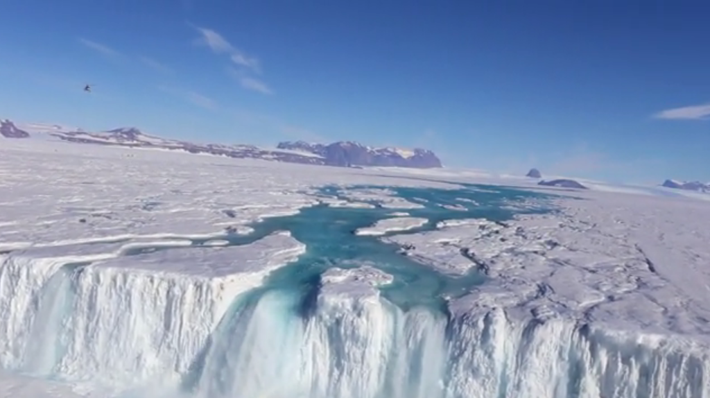
A 400-foot-wide waterfall drains off the Nansen Ice Shelf into the ocean.
(Image by Won Sang Lee/Korea Polar Research Institute)
For the first time ever, researchers have mapped out the movement of water across Antarctica in an intricate network of lakes and streams. Researchers catalogued satellite images and aerial photographs of the continent starting from the late 1940s. In their analysis of the images, researchers found nearly 700 seasonal systems of interconnected ponds, channels and braided streams fringing Antarctica on all sides. It’s not clear whether the number of drainages has increased over the past 70 years, but mapping their size will be crucial to observe possible effects of climate change in the future.
Authors:
Jonathan Kingslake, Jeremy C. Ely, Indrani Das & Robin E. Bell
Corresponding author:
Jonathan Kingslake, Columbia University, New York, NY, Email: j.kingslake@columbia.edu
Original paper published in Nature on April 19, 2017.