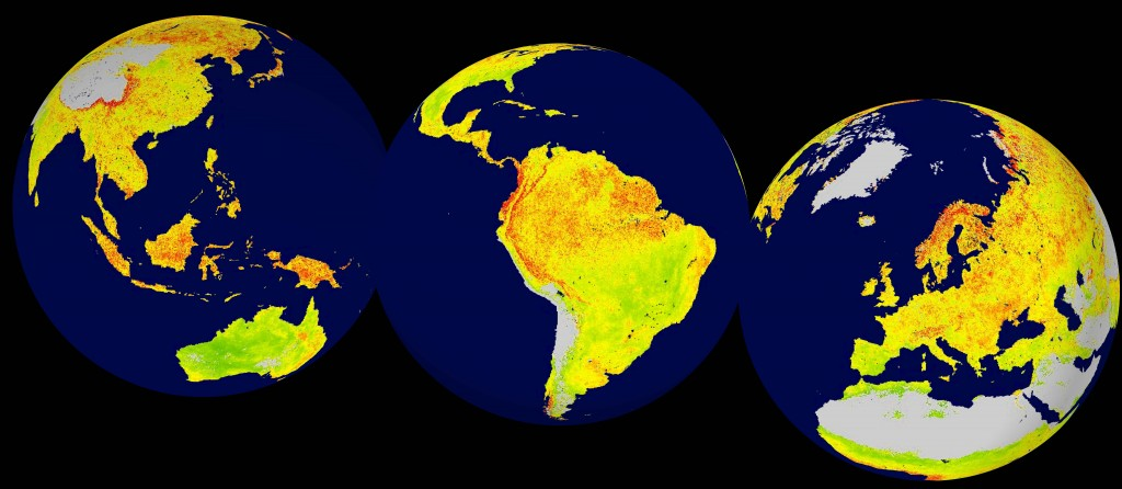
Global snapshot of the Vegetation Sensitivity Index (VSI), a new indicator of vegetation sensitivity to climate variability. Areas in green (red) have comparatively lower (higher) vegetation sensitivity. Grey areas are barren land or ice covered. (Image credit: Seddon et al)
The areas of the world most sensitive to climate variation have been mapped by researchers. Using 14 years of satellite data researchers were able to develop the vegetation sensitivity index.
The index is based on three variables that drive vegetation production – air temperature, water availability, and the degree of cloud cover.
The researchers believe the map could provide a method of quantifying the relative response rates of ecosystems to environmental change, whether natural or anthropogenic.
Original research paper published in Nature on February 17, 2015.
Names and affiliations of selected authors